Field trip to contech.

FIELD OBSERVATION MEMORANDUM
To: Tom
Szymoniak
From: Duc
Ly
Date: October
23, 2014
Subject: ConTech Office Visit
Team Delta from the CE111
Introduction to Civil Engineering class visited Contech Engineered Solutions at
11835 NE Glenn Widing Drive on Wednesday, October 23, 2014. The purpose of this visit was for students to
learn the different types of work civil and environmental engineers do in a
company. Our host was Travis, a civil
engineer project manager. The visit
lasted approximately one hour. Travis
presented a Power Point presentation. His
presentation focused on Contech storm water products and services, The engineering team behind the business and
the education of a well-rounded engineer.
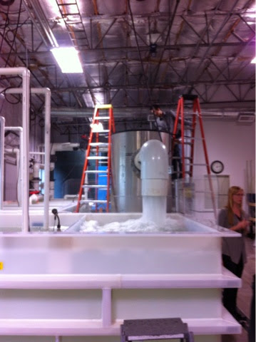
We then briefly toured the lab with lab manager Debbie Beck and Jim
Lenhart. Observation and discussion are
presented below.
Observations and Information
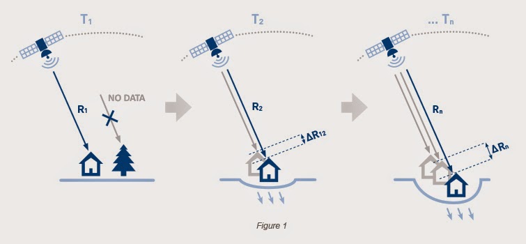
Travis began the presentation
with the hydrological cycle. Contech
Company produces pumps, storm filters, and other items to control flooding in
parking lots, housing developments and a variety of different sites. The company makes green-water harvesting
apparatus, “tree in a box”, storm filter, hydro trash separator. Their focus is on hydrodynamics, treatment
and detention. Multiple products work
together on the same site to control, recycle, and mitigate environmental
impacts. Contech also provides field
monitoring.
Contech engineering team does
product research and development, testing of products; invent new machines to
perform the job more efficiently through value engineering. Their engineers provide a resource to
potential clients to help them select the right product for the right job. The engineers often work with the city to
improve or upgrade the code for stricter environmental regulation. The office has a few scientist, three or four
environmental engineers and geotechnical engineers.
Travis showed two slides of
skills not learned in school that he saw lacking in recent graduates and interns. He emphasized written and verbal
communication, presentation, time managements and teamwork. He sees business these essential skills are
just as important as engineering skills.
Jim also express hands on experience such as construction, operating and
logistics as an important part of a project completion, installation, and
maintenance of products used to mitigate the water resource.
Discussion
One main theme of Travis’s
presentation was the diverse set of skills that is necessary to succeed as an
engineer. Even though Contech’s emphasis
is on selling products and improving profits, there is an engineering team
behind the product doing research which in turn provides a better and more
innovative storm pump to help clean up the environment.
Jim Lenhart demonstrated his
invention for a storm pump which uses basic fundamental knowledge of hydro
static pressure to create a more efficient pump. It is refreshing to see that not all
engineering work is codes and calculations.
To be a well-rounded engineer requires business skill as well and
creative vision to make better products.
Debbie Beck pointed out that because Contech is a private company, she
doesn’t have to write grant proposals for research and development like some
public and academic institutions. Business
is the driving force behind the research and the environment can benefit. Business and sale has had a negative
connotation in the engineering field.
Both Jim and Travis commented that as a consultant engineer, they both
engage at a sale and service level.
Conclusion
Overall, the visit to Contech
office was very useful for increasing my understanding of how business, sales,
and product intertwine in the engineer’s profession. I also learned more about other skills sets
that I would need to succeed as an engineer in the business world. The trip would have been even more
educational if I had learned more about what an intern or a recent graduate
daily work routine.